
Calumet County, Wisconsin Property Records Search
Search Calumet County property records by owner name, parcel number, property address, ZIP code, city, or advanced criteria to locate parcel and property information quickly.
Total Parcels
29,517
Municipalities
20
Matched Addresses
25,596
Matched Buildings
34,487
Standardized Zoning
29,287
Related Calumet County Property Resources
Property records are often only the starting point for researching a parcel. These related resources can help you examine taxes, transfers, maps, zoning, and local property topics from different angles
Property Tax Calculator
Estimate property-tax amounts using the information relevant to a Calumet County property.
Property Tax Rates
Check current Calumet County tax rates and see how local taxing jurisdictions can affect your property's annual tax bill.
Transfer Fee Calculator
Use transfer-related calculations when reviewing a property sale, ownership change, or real estate transaction
County Map
Explore geographic information and property locations through a dedicated county map resource.
Zoning Information
Review zoning-related information and land-use considerations before researching a property's permitted use.
Calumet County Real Property Lister and Land Information
Calumet County uses a Real Property Lister within the County Treasurer’s office to maintain tax-roll information and process property-transfer information. Municipal assessors establish assessed values, while the Real Property Lister incorporates those values into the county’s property-tax records. The county’s Land Information Office separately coordinates land-record activity and GIS resources.
- (920) 849-1457
- marissa.heimerl@calumetcounty.org
- 206 Court Street, Chilton, WI 53014
- Monday–Friday, 8:00 AM–4:30 PM
- Records Maintained: Tax Records & Assessed Values
- Tax Services: Second Installment & Delinquent Real Estate Taxes
Calumet County Real Estate Statistics
Housing statistics provide useful context when a property record is being reviewed alongside broader market conditions. The following figures come from the U.S. Census Bureau and represent the latest available periods shown for Calumet County.
Home Value
Typical owner-occupied home value
Homeownership Rate
Owner-occupied housing share
Median Household Income
Median household income
Monthly Mortgage Cost
Median cost with mortgage
Median Gross Rent
Typical monthly gross rent
Building Permits
Permits issued during 2025
How to Search Calumet County Property Records
Different search methods work better depending on what you already know about the parcel. A full street address is useful for a known property, while an owner or parcel number can be more effective when researching ownership or tax records.
Different search methods work better depending on what you already know about the parcel. A full street address is useful for a known property, while an owner or parcel number can be more effective when researching ownership or tax records.

A parcel number is one of the most reliable ways to locate a specific Adams County property record. Enter the parcel number exactly as shown on a tax bill, assessment record, or other property document. Check each digit before searching because one incorrect number can return a different property or no matching result.
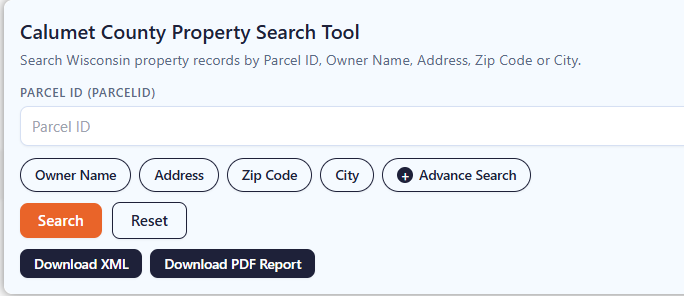
If the property address is available, select the Address option and enter the street information carefully. Include the house number and street name as they appear in the property record. If the property checker does not return the expected result, review the spelling, street abbreviations, and house number before trying again.

The ZIP Code option can help when you know the property’s general location but do not have its parcel number or complete address. Enter the five-digit ZIP code and review the matching properties. Since multiple parcels can share the same ZIP code, compare the displayed addresses and owner information to identify the correct property.

Choose City Name when you know where the property is located but do not have enough information for an address or owner search. Enter the applicable city name and review the available records. The Adams County property search tool can then help narrow the results until you find the property you’re looking for.

Advanced Search is useful when you have several pieces of property information and want to narrow the results. Depending on the available fields, you can use additional details to make the search more specific. Enter only information you know is correct, then review the results carefully before opening a property record.

Information Can You Find
A property-record result can bring together several types of information about a parcel, from basic identification and location details to ownership, valuation, acreage, classification, and geographic information. Available fields can vary by record and data source.
Property Identification
A parcel record normally begins with identifiers that distinguish one property from another. A Parcel ID or Tax Parcel ID can serve as the key reference for the property. These identifiers are particularly helpful when communicating with a municipal assessor, Real Property Lister, GIS office, lender, title professional, or other party researching the same parcel.
Owner Information
Ownership information may show the owner name associated with the parcel and, where available, a mailing address. The mailing address may differ from the physical property location, particularly for rental properties, agricultural land, investment properties, trusts, or owners who live elsewhere. Use this information as a record reference rather than assuming it establishes every aspect of legal ownership.
Property Address
The site address identifies where the property is physically located. Street number, street name, unit information, place name, ZIP Code, and state can help distinguish neighboring parcels with similar names. Rural properties may have addressing characteristics that differ from conventional residential streets, so comparing the address with the parcel location can be useful.
Tax Roll Information
Tax-roll fields can identify the applicable roll year or other record dates associated with the parcel. These dates matter because assessment and tax information can change from one year to another. When comparing records, make sure you are not treating an older tax-roll figure as though it represents the property’s current assessment.
Land and Improvement Values
Some records separate the value attributed to the land from the value associated with improvements. This distinction can be helpful when studying vacant land, residential structures, agricultural properties, or parcels where the building represents a substantial portion of the assessed value. Comparing these components can provide more context than looking at one combined number.
Property Classification
Property class and related classification fields help describe how a parcel is categorized in the underlying property dataset. Classification can be relevant when comparing residential, commercial, agricultural, manufacturing, or other property types. The exact meaning of a classification should be interpreted using the applicable local or dataset definitions rather than assuming every code has the same meaning statewide.
Geographic and Mapping Information
Latitude, longitude, GIS acres, parcel geometry, and related mapping information can help place a property spatially. Calumet County’s Land Information Office maintains GIS resources and coordinates county land-record activities. Mapping data can be useful for understanding parcel location, neighboring land, and geographic relationships, but it should not substitute for a legal survey.
Property Acreage
A property record may contain more than one acreage measurement, including assessed acres, deed acres, or GIS-derived acreage. These values can differ because they originate from different records or calculation methods. For land research, comparing the available acreage fields can help identify discrepancies that may warrant a closer look at the deed, survey, or official mapping information.
School District Information
Some property records may include school-district or place-related information associated with the parcel. This can help users organize property research by community or education area. School-district boundaries can change and may not match municipal boundaries, so information shown in a property database should be confirmed with the relevant school district when boundary accuracy is important.
GIS Location and Record Source
For geographic reference, the record contains latitude, longitude, shape area, and shape length fields. It also includes the county name, load date, parcel source, and parcel source reference. Together, these fields provide mapping, geographic, update, and source-related information connected with the parcel record.
Areas Covered by the Calumet County Property Search Tool
The property database covers locations throughout Calumet County, including its cities, villages, and towns. The county officially lists 20 local municipalities, providing coverage across both incorporated communities and surrounding rural areas.
City of Appleton
City of Brillion
City of Chilton
City of Kaukauna
City of Kiel
City of Menasha
City of New Holstein
Village of Harrison
Village of Hilbert
Village of Potter
Village of Sherwood
Village of Stockbridge
Town of Brillion
Town of Brothertown
Town of Charlestown
Town of Chilton
Town of New Holstein
Town of Rantoul
Town of Stockbridge
Town of Woodville
Calumet County Information and Local Facts
Calumet County sits in east-central Wisconsin, with Chilton serving as the county seat. Its geography combines agricultural land, communities, the Niagara Escarpment, and a substantial Lake Winnebago shoreline. The following facts provide useful context for property research and local geography
| County Fact | Calumet County Information | County Fact | Calumet County Information |
|---|---|---|---|
| County Seat | Chilton | State | Wisconsin |
| FIPS Code | 55015 | 2025 Population Estimate | 53,982 |
| 2020 Census Population | 52,442 | 2010 Census Population | 48,971 |
| 2020 Population Density | 164.8 people per sq. mi. | 2020 Land Area | 318.25 sq. mi. |
| 2020–2024 Households | 21,372 | 2020–2024 Persons per Household | 2.47 |
| 2020–2024 Owner-Occupied Rate | 80.1% | 2020–2024 Median Home Value | $274,200 |
| 2020–2024 Median Household Income | $88,810 | 2020–2024 Median Gross Rent | $1,073 |
| 2020–2024 Median Mortgage Costs | $1,677 per month | 2025 Building Permits | 242 |
| Approximate Lake Winnebago Shoreline | 23 miles | Interior Lakes | 14 identified lakes |
| Agricultural Land Use | More than 60% of county area | County Formation | Created in 1836 |
| Major Geographic Feature | Niagara Escarpment | Major Water Feature | Lake Winnebago |
| Local Government Units | 20 listed municipalities | Nearby Wisconsin Counties | Brown, Manitowoc, Sheboygan, Fond du Lac, Winnebago, Outagamie |
Nearby Wisconsin Counties for Property Searches
Property research sometimes crosses county lines, especially around communities connected to larger regional markets. From this page, you can also explore property records in neighboring Wisconsin counties to compare parcels, ownership information, assessments, and other available property data
Frequently Asked Questions
How can I find a property in Calumet County without knowing the parcel number?
You can begin with the owner’s name, street address, ZIP Code, or city name. Using the information you already have is often enough to narrow the available property records and identify the corresponding parcel.
What is the difference between a parcel number and a property address?
A property address describes the physical location used for mailing or navigation, while a parcel number is an identifier assigned to a specific property record. A parcel number can remain useful even when an address changes.
Can I search Calumet County property records by owner name?
Yes. Owner-name searching is useful when you know who is associated with a property but do not have its exact address or parcel identifier. Check spelling variations and consider that one owner may appear on multiple records.
Can I search a vacant lot using the property finder?
Yes, if the vacant parcel has a corresponding property record in the database. Vacant land may not have building-related information, but the parcel itself can still have identifying, ownership, location, assessment, or geographic information.
Does every Calumet County property have the same type of assessment information?
Not necessarily. Property records can contain different fields depending on the parcel, municipality, tax year, classification, and available source data. Assessment figures should be interpreted in the context of the applicable record year.
Can I search properties in rural areas of Calumet County?
Yes. The county includes eight towns in addition to its cities and villages. Rural parcels can be searched using available identifiers such as an owner name, address, parcel number, ZIP Code, or other supported criteria
Why might the mailing address differ from the property's location?
A property owner may live somewhere other than the property itself. This is common with rental properties, farmland, investment properties, trusts, and businesses. A record may therefore show a mailing address that is different from the physical site address.
What does acreage mean on a property record?
Acreage describes the reported size of the parcel, but a record can contain different acreage fields. Assessed, deed, and GIS acreage may be calculated or sourced differently, so they should not automatically be assumed to be identical.
Can I use the property search to research an old property record?
That depends on the records and historical information available in the underlying database. If you are researching an older ownership or property history, verify the information against the appropriate county records or other official documents.
Can property records show information about zoning?
Property records and zoning information are related but are not necessarily the same thing. Calumet County has a Planning, Zoning, and Land Information Department, and zoning jurisdiction can depend on the municipality and applicable regulations. Verify land-use questions with the appropriate local office.