
Jefferson County, Wisconsin Property Records Search
Search Jefferson County property records by Owner Name, Parcel Number, Property Address, ZIP Code, City Name, or Advanced Search to find parcel, ownership, assessment, location, and related property information.
Total Parcels
44,880
Municipalities
27
Matched Addresses
43,093
Matched Buildings
61,263
Standardized Zoning
44,585
Explore More Jefferson County Property Tools
Property research may continue beyond a parcel lookup. These related resources can help with tax calculations, transfers, mapping, zoning questions, and broader real-estate research.
Property Tax Calculator
Estimate property-tax costs using relevant property information and applicable tax assumptions.
Property Tax Rates
Check current Jefforson County tax rates and see how local taxing jurisdictions can affect your property's annual tax bill.
Transfer Fee Calculator
Review potential transfer-tax calculations when researching a property sale or ownership transfer.
County Map
Explore property locations, municipal boundaries, roads, waterways, and other geographic features
Zoning Information
Research zoning and land-use information when evaluating a property's permitted uses or development potential.
Jefferson County Property Assessment Office
Jefferson County’s Land Information Office coordinates parcel mapping and property-related information, while the Real Property Lister maintains parcel and assessment-related records and works with local assessors. The Register of Deeds separately maintains recorded real-estate documents
- (920) 674-7254
- tracys@jeffersoncountywi.gov
- 311 S. Center Avenue, Jefferson, WI 53549
- Monday–Friday, 8:00 AM–4:30 PM
- Records Maintained: Tax Records & Assessed Values
- Tax Services: Second Installment & Delinquent Real Estate Taxes
Jefferson County Real Estate Statistics
Housing statistics provide a useful countywide backdrop when a parcel lookup is part of a larger property comparison. The latest Census QuickFacts figures below use the applicable 2020–2024 or 2025 reference period.
Home Value
Typical owner-occupied home value
Homeownership Rate
Owner-occupied housing share
Median Household Income
Median household income
Monthly Mortgage Cost
Median cost with mortgage
Median Gross Rent
Typical monthly gross rent
Building Permits
Permits issued during 2025
How to Search Jefferson County Property Records for Free
Search by owner name when you know the person or organization connected to the property but do not have its parcel number. Enter the name as accurately as possible, then compare returned records using location or address information. This approach can be helpful for finding multiple properties associated with the same owner, although common names may require additional filtering.
If you know the property owner’s name, enter the complete name in the owner search field. A parcel can have more than one owner, so check whether the record lists a primary or secondary owner. For better results with the property finder, avoid unnecessary initials and enter the owner’s name as accurately as possible.

A parcel number is one of the most reliable ways to locate a specific Adams County property record. Enter the parcel number exactly as shown on a tax bill, assessment record, or other property document. Check each digit before searching because one incorrect number can return a different property or no matching result.

If the property address is available, select the Address option and enter the street information carefully. Include the house number and street name as they appear in the property record. If the property checker does not return the expected result, review the spelling, street abbreviations, and house number before trying again.

The ZIP Code option can help when you know the property’s general location but do not have its parcel number or complete address. Enter the five-digit ZIP code and review the matching properties. Since multiple parcels can share the same ZIP code, compare the displayed addresses and owner information to identify the correct property.
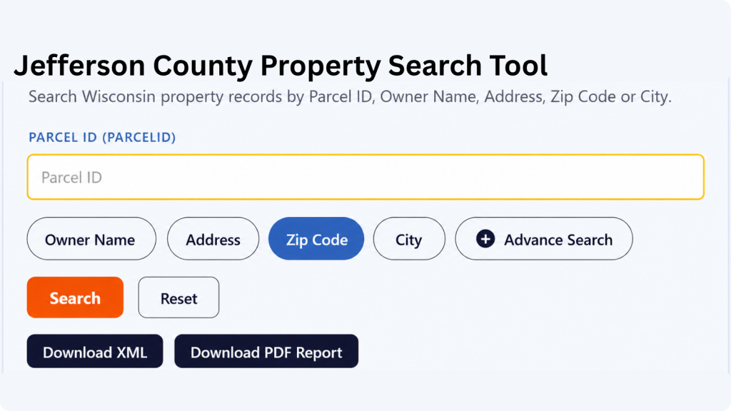
Choose City Name when you know where the property is located but do not have enough information for an address or owner search. Enter the applicable city name and review the available records. The Adams County property search tool can then help narrow the results until you find the property you’re looking for.

Advanced Search is useful when you have several pieces of property information and want to narrow the results. Depending on the available fields, you can use additional details to make the search more specific. Enter only information you know is correct, then review the results carefully before opening a property record.

What Information Can You Find in an Jefferson County Property Record?
Property records can combine several kinds of information in one result, including ownership, parcel identification, location, assessments, classifications, acreage, and geographic references. The precise fields available depend on the underlying dataset and the particular property record.
Parcel and Tax Identification
The parcel ID provides a distinct reference for the property record. It is useful for keeping research organized because an address or ownership detail may change over time. Retaining the parcel identifier alongside your notes can make it easier to compare the same property with tax, mapping, assessment, or recorded-document information.
Property Owner Information
Owner fields identify the individual or organization associated with a parcel in the dataset. A mailing address may also be displayed and can differ from the property’s physical address. That distinction is useful for rental properties, farms, businesses, second homes, and parcels owned by people whose primary residence is elsewhere.
Property Address and Location
The site address identifies the physical location of the property, while mailing information describes where correspondence is directed. Comparing these fields can help confirm that a returned record belongs to the property you are researching, particularly when multiple properties have similar street names or when rural addresses use different locality conventions.
ZIP Code and State Details
The property checker includes the property’s five-digit ZIP code, ZIP+4, and state information. These fields are useful when confirming the location shown in a record or narrowing down properties with the same general area. Having both ZIP and ZIP+4 information can also provide a more specific postal reference when it is available.
Tax Roll Information
Tax-roll fields identify the taxation or assessment period represented by the database record. This can help establish when the displayed information applies. A tax-roll record should not automatically be interpreted as the current amount owed or proof that a tax bill has been paid; current payment questions should be directed to the appropriate treasurer.
Estimated Market and Property Tax Values
Assessment-related value fields help describe how a parcel is represented for property-tax purposes. They can be useful when comparing properties, but an assessed value is not necessarily a current appraisal or market price. Buyers and sellers should use appropriate valuation resources when determining market value.
Property Classification
Property classification identifies the category assigned to a parcel in the assessment data. It can help researchers understand how properties are grouped for taxation and comparison. Classification should not be confused with zoning: permitted uses and development restrictions require review of the applicable land-use regulations.
Property Acreage
Acreage information provides a useful indication of parcel size. Where multiple acreage measurements are available, they may represent different source records or purposes, such as deed, assessment, or GIS acreage. Differences should not automatically be considered errors, and legal boundary questions require authoritative documents or a professional survey.
School District Information
The property record includes the school district name and school district number associated with the parcel. This can be useful when researching a property’s local area, especially when comparing properties that may have different school district assignments despite being relatively close to one another.
GIS Location and Record Source
For geographic reference, the record contains latitude, longitude, shape area, and shape length fields. It also includes the county name, load date, parcel source, and parcel source reference. Together, these fields provide mapping, geographic, update, and source-related information connected with the parcel record.
Areas Covered by the Jefferson County Property Search Tool
Jefferson County’s civil structure includes 16 towns, five villages, and six cities. Several municipalities cross the county boundary, making it useful to verify the actual parcel jurisdiction when conducting property research.
Town of Aztalan
Town of Cold Spring
Town of Concord
Town of Farmington
Town of Hebron
Town of Ixonia
Town of Jefferson
Town of Koshkonong
Town of Lake Mills
Town of Milford
Town of Oakland
Town of Palmyra
Town of Sullivan
Town of Sumner
Town of Waterloo
Village of Sullivan
City of Fort Atkinson
City of Jefferson
City of Lake Mills
City of Waterloo
City of Watertown
City of Whitewater
Village of Cambridge
Village of Johnson Creek
Village of Lac La Belle
Village of Palmyra
Jefferson County, Wisconsin: Local Facts
Jefferson County sits between the Madison and Milwaukee metropolitan areas. Its landscape includes agricultural areas, rolling terrain, waterways, established communities, and transportation corridors connecting southeastern Wisconsin. Jefferson is the county seat.
| County Detail | Jefferson County | County Detail | Jefferson County |
|---|---|---|---|
| County Seat | Jefferson | State | Wisconsin |
| FIPS Code | 55055 | County Established | 1836 |
| Organized as County Government | 1839 | 2025 Population Estimate | 87,174 |
| 2020 Census Population | 84,900 | Land Area | 556.49 sq. mi. |
| Approx. Total County Area | 583 sq. mi. | Population Density | 152.6 people / sq. mi. in 2020 |
| Civil Municipalities | 27 | Towns | 16 |
| Villages | 5 | Cities | 6 |
| 2020–2024 Households | 34,873 | Persons per Household | 2.37 (2020–2024) |
| Median Household Income | $83,750 (2020–2024) | Median Owner-Occupied Home Value | $274,100 (2020–2024) |
| Major River | Rock River | Major Interstate | Interstate 94 |
| Major Water Features | Lake Koshkonong and other inland lakes | ||
Nearby Wisconsin Counties to Search
Jefferson County sits at a crossroads between several southeastern Wisconsin communities. If a property lies close to the county line, checking the neighboring county database can help confirm jurisdiction or locate a parcel that is outside Jefferson County.
Frequently Asked Questions
1. How many municipalities are in Jefferson County?
Jefferson County has 27 civil municipalities: 16 towns, five villages, and six cities. Some of these jurisdictions extend across the county boundary, so a community name does not always mean the entire municipality is located inside Jefferson County.
2. What is the county seat of Jefferson County?rch to check a property I do not own?
The City of Jefferson is the county seat. The county courthouse is located at 311 S. Center Avenue in Jefferson, Wisconsin.
3. Who maintains Jefferson County parcel information?
The Jefferson County Land Information Office and Real Property Lister are responsible for important parcel, assessment, mapping, and land-information functions. The county’s parcel workflow includes creating parcel records, assigning parcel IDs, maintaining parcel geometry, and incorporating assessment information.
4. Can I search a property when I only know the owner's name?
Yes. An owner-name search can be used when the parcel number is unknown. If several records appear for the same or similar names, use address, municipality, ZIP code, or other available information to identify the correct property.
5. Are Jefferson County property records the same as recorded deeds?
No. A parcel database and recorded land documents serve different purposes. The Register of Deeds maintains recorded real-estate documents, including deeds and other instruments, while property and GIS systems organize parcel, assessment, and geographic information.
6. Why might a municipality appear to cross the Jefferson County boundary?
Several Jefferson County municipalities cross county lines. Watertown extends into Dodge County, Whitewater into Walworth County, Cambridge into Dane County, and Lac La Belle is primarily in Waukesha County. This is important when determining which county’s property records apply
7. Does an assessed value tell me what a property is worth today?
Not necessarily. An assessment value is part of the property-tax system and should not automatically be treated as a current market valuation. A market appraisal, recent comparable sales, and other relevant evidence may be needed for a current value assessment.
8. Where can I find official Jefferson County real-estate documents?
The Register of Deeds maintains recorded real-estate documents. Its office is at 311 South Center Avenue, Room C1030, Jefferson, WI 53549, with regular weekday office hours. The office can be reached at 920-674-7235
9. Can GIS coordinates establish a property's legal boundary?
No. Coordinates and GIS parcel displays are useful for geographic reference, but they are not a replacement for a legal survey or authoritative legal description. Boundary questions should be resolved through appropriate land records and qualified surveying professionals.
10. Which counties directly border Jefferson County?
Jefferson County directly borders Dodge County to the north, Waukesha County to the east, Walworth County to the southeast, Rock County to the southwest, and Dane County to the west