
Dodge County Wisconsin Property Records Search
Search Dodge County property records by owner name, parcel number, property address, ZIP code, city name, or advanced criteria to locate parcel details, ownership information, values, acreage, and other available property data.
Total Parcels
47,966
Municipalities
43
Matched Addresses
46,032
Matched Buildings
72,965
Standardized Zoning
42,708
Related Dodge County Property Resources
Property research often involves more than identifying a parcel. Use the related resources below to move from a basic property lookup into taxes, maps, zoning information, and local research.
Property Tax Calculator
Estimate property tax amounts and understand how assessed property information can relate to a tax calculation
Property Tax Rates
Check current Dodge County tax rates and see how local taxing jurisdictions can affect your property's annual tax bill.
Transfer Fee Calculator
Use the transfer-tax resource to explore transaction-related tax calculations when researching a property transfer.
County Map
Explore geographic property information and use mapping resources to understand parcel location, boundaries, and surrounding land.
Zoning Information
Review zoning-related information and identify the appropriate local jurisdiction before making land-use decisions
Dodge County Property Listing and Land Information
Dodge County’s Land Information Division includes the Property Listing, GIS, and Survey functions. The Property Listing office maintains ownership and property-description information for parcels throughout the county, while GIS supports mapping and spatial analysis. The office works with municipal assessors and other agencies to maintain parcel information and tax-map layers.
- (920) 386-3772
- treasurer@co.dodge.wi.us
- 127 E. Oak St., Administration Building, 3rd Floor, Juneau, WI 53039
- Monday–Friday, 8:00 AM–4:30 PM
- Dodge County Land Information / Property Listing
- Tax Services: Second Installment & Delinquent Real Estate Taxes
Dodge County Real Estate Statistics
These figures provide useful context when reviewing a parcel record. They can help put property values, housing costs, ownership patterns, and local construction activity into perspective without treating countywide statistics as the value of an individual property.
Home Value
Typical owner-occupied home value
Homeownership Rate
Owner-occupied housing share
Median Household Income
Median household income
Monthly Mortgage Cost
Median cost with mortgage
Median Gross Rent
Typical monthly gross rent
Building Permits
Permits issued during 2025
How to Search Dodge County Property Records for Free
The best search method depends on what you already know. A parcel number is usually the most precise starting point, while an owner, address, ZIP code, or city can be more useful when you are beginning with incomplete property information
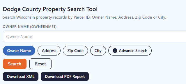
An owner-name search works well when you know the individual, business, trust, or other ownership name associated with a parcel. Use the name as accurately as possible, then review the returned records for matching properties. This approach can be useful when researching multiple parcels connected to one owner. Because names may appear differently across records, try a shorter or alternate version if the first search produces no useful results.
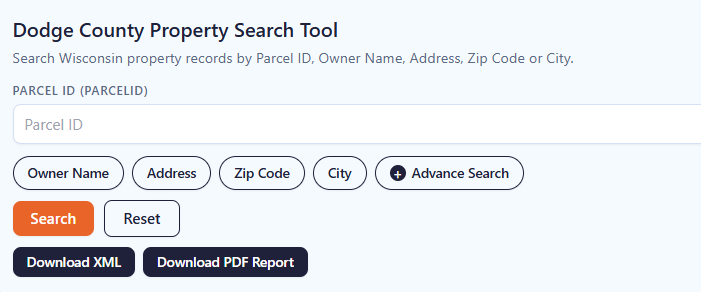
A parcel number is one of the most reliable ways to locate a specific Adams County property record. Enter the parcel number exactly as shown on a tax bill, assessment record, or other property document. Check each digit before searching because one incorrect number can return a different property or no matching result.
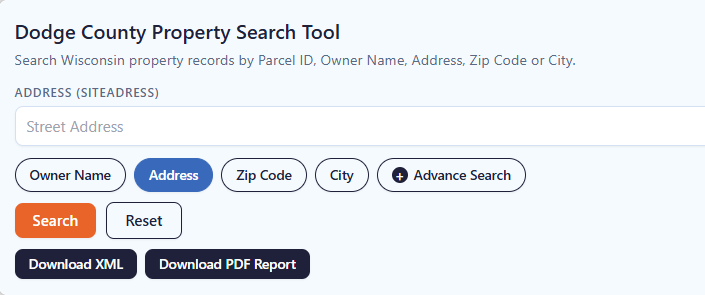
If the property address is available, select the Address option and enter the street information carefully. Include the house number and street name as they appear in the property record. If the property checker does not return the expected result, review the spelling, street abbreviations, and house number before trying again.
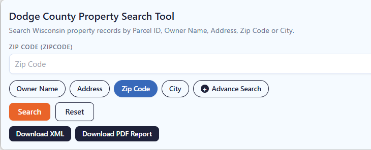
The ZIP Code option can help when you know the property’s general location but do not have its parcel number or complete address. Enter the five-digit ZIP code and review the matching properties. Since multiple parcels can share the same ZIP code, compare the displayed addresses and owner information to identify the correct property.
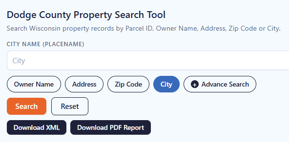
Choose City Name when you know where the property is located but do not have enough information for an address or owner search. Enter the applicable city name and review the available records. The Adams County property search tool can then help narrow the results until you find the property you’re looking for.
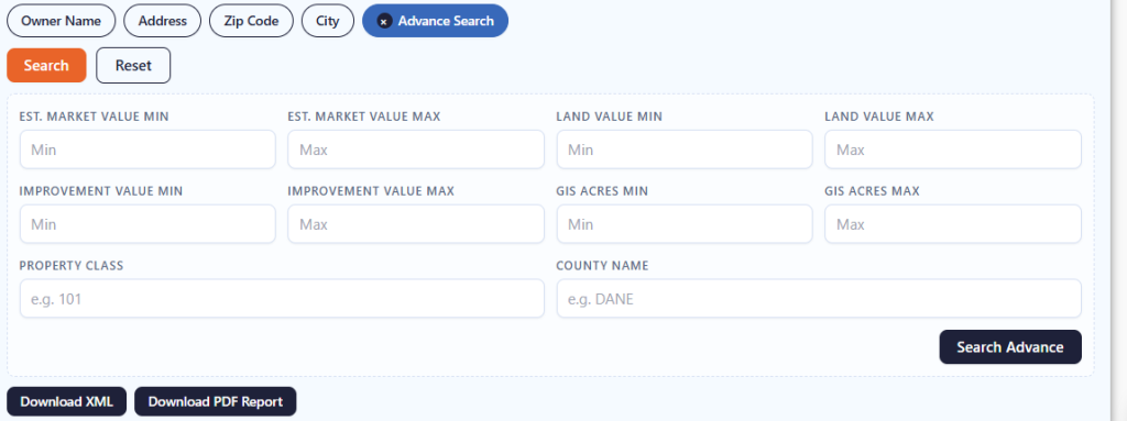
Advanced Search is useful when you have several pieces of property information and want to narrow the results. Depending on the available fields, you can use additional details to make the search more specific. Enter only information you know is correct, then review the results carefully before opening a property record.
What Information Can You Find in Dodge County Property Record?
A property-record result can bring together several types of information rather than simply showing an owner’s name. Depending on the available record, you may encounter identification, location, ownership, valuation, acreage, classification, school-district, mapping, and source information.
Property Identification
The parcel ID or tax parcel identifier gives the record a distinct reference within the property dataset. It is useful when you need to return to the same property later or compare information across documents. For formal transactions, verify the parcel identifier against current official records because parcel information can change through divisions, combinations, annexations, or other land-record activity.
Ownership Details
Ownership information can identify the name associated with a parcel and may include a mailing address. This is useful when connecting a property to an individual, organization, or other recorded ownership entity. A mailing address may differ from the physical property location, particularly for rental, agricultural, investment, or commercial properties, so the two should not be assumed to represent the same location.
Site Address
The site address describes where the property is physically located. It provides a convenient way to connect a parcel record with a street location, but rural and undeveloped parcels may have limited or differently formatted address information. Comparing the site address with the municipality, ZIP code, parcel map, and geographic details can help confirm that the record corresponds to the property you are researching.
Municipality and Location
A parcel record can include place or municipality information that helps establish its local setting. This matters in Dodge County because property administration is divided among cities, villages, and towns. Local jurisdiction can affect assessment, zoning, permitting, and other property matters. The municipality associated with a parcel is therefore an important detail to check before contacting a local office.
Property Values
Available records may show assessed value or other property-related valuation fields. Assessed value is used within the property-tax system and should not automatically be interpreted as the property’s current market selling price. Values may also correspond to a particular assessment or tax-roll year. Check the applicable year before comparing figures from different records.
Land and Improvements
Some records separate the value attributed to land from the value associated with improvements. This distinction can help users understand how a property’s total assessed amount is represented. A developed residential parcel, for example, may have both land and improvement components, while vacant land may have little or no improvement value. The precise fields available depend on the underlying property record.
Property Classification
Property classification helps describe how a parcel is categorized within the assessment or property-data system. Classification can be relevant when comparing residential, commercial, agricultural, manufacturing, or other property types. It should not be confused with zoning. Property classification concerns the record’s assessment or property category, while zoning relates to permitted land uses and development regulations.
Property Acreage
A parcel can contain more than one acreage measurement, such as assessed, deed, or GIS acreage. These measurements may differ because they originate from different sources or calculation methods. Acreage is particularly useful when researching rural land, agricultural parcels, large lots, or potential development sites. For a legal boundary determination, rely on an appropriate survey or recorded legal documentation rather than a database acreage figure alone.
School District Information
School-district information can connect a property with the district associated with its location for property-data purposes. This can be useful when researching residential properties or examining local tax and geographic context. School boundaries are separate from parcel boundaries and can change over time, so users should verify current district information when it is important to a purchase or other decision.
GIS and Mapping Information
Geographic fields such as latitude, longitude, parcel geometry, and mapping-related identifiers can help place a property on a map. Dodge County’s GIS program maintains geographically referenced datasets and supports county and municipal mapping needs. Mapping information is valuable for visual research, but a GIS parcel representation should not be treated as a substitute for a professional land survey.
Areas Covered by the Dodge County Property Search Tool
The property database spans Dodge County’s incorporated cities and villages as well as its towns. The county currently identifies 23 towns, 11 villages, and 9 cities, giving users coverage across 43 municipalities
Town of Ashippun
Town of Beaver Dam
Town of Burnett
Town of Calamus
Town of Chester
Town of Clyman
Town of Elba
Town of Emmet
Town of Monroe
Town of Fox Lake
Town of Herman
Town of Hubbard
Town of Hustisford
Town of Lebanon
Town of LeRoy
Town of Lomira
Town of Lowell
Town of Oak Grove
Town of Portland
Town of Rubicon
Town of Shields
Town of Theresa
Town of Trenton
Town of Westford
Village of Brownsville
Village of Clyman
Village of Hustisford
Village of Iron Ridge
Village of Kekoskee
Village of Lomira
Village of Lowell
Village of Neosho
Village of Randolph
Village of Reeseville
Village of Theresa
City of Beaver Dam
City of Columbus
City of Fox Lake
City of Hartford
City of Horicon
City of Juneau
City of Mayville
City of Watertown
City of Waupun
Dodge County, Wisconsin Information
Dodge County sits in south-central Wisconsin and combines agricultural land, established communities, lakes, rivers, and urbanized areas. Its county seat is Juneau, while Beaver Dam is the largest city located within the county.
| County Detail | Dodge County | County Detail | Dodge County |
|---|---|---|---|
| County Seat | Juneau | State | Wisconsin |
| FIPS Code | 55027 | County Created | 1836 |
| County Organized | 1844 | 2020 Census Population | 89,396 |
| 2025 Population Estimate | 89,097 | Land Area | 875.70 sq. mi. |
| Total Area | Approximately 907 sq. mi. | Water Area | Approximately 31 sq. mi. |
| Population Density | 102.1 people / sq. mi. in 2020 | Households | 35,910 (2020–2024) |
| Housing Units | 39,030 (July 2025) | Owner-Occupied Housing Rate | 71.3% (2020–2024) |
| Median Owner-Occupied Home Value | $231,900 (2020–2024) | Median Household Income | $75,929 (2020–2024) |
| Median Gross Rent | $988 (2020–2024) | Monthly Owner Costs With Mortgage | $1,557 (2020–2024) |
| Building Permits | 356 in 2025 | Geographic Setting | South-central Wisconsin |
| Major Water Features | Beaver Dam Lake, Fox Lake, Lake Sinissippi, and Rock River | ||
Nearby Wisconsin Counties to Explore
Property research often crosses county lines, particularly around communities near Dodge County’s borders. The surrounding Wisconsin counties below provide useful next stops when a property, mailing address, municipality, or landholding extends outside the county.
Frequently Asked Questions
1. What is the best way to find a Dodge County property by parcel number?
A parcel number is generally the most precise search starting point because it is designed to identify a particular parcel. Use the complete number available on your property documents and compare the resulting address and owner information with your records.
2. Can I look up a property in Beaver Dam without knowing its parcel number?
Yes. An address, owner name, ZIP code, or city search can be used when the parcel number is unavailable. Searching by street address is often the simplest option when you know where the property is located.
3. Are Dodge County property records limited to cities?
No. Dodge County’s municipal structure includes cities, villages, and towns. Its Land Information Division maintains parcel information across the county, while individual municipal assessors handle property assessments within their jurisdictions.
4. How can I research a property when the owner's name is unknown?
Start with the physical address, ZIP code, or city. Once a matching parcel is located, the available record may provide ownership information and other identifying details that can help with further research.
5. Does a property record show the property's market value?
Not necessarily. A record may contain assessed value, land value, improvement value, or other valuation fields. These figures serve specific property-record or assessment purposes and should not automatically be treated as a current market listing price.
6. Why might land acreage differ between two property records?
Acreage can be calculated or reported from different sources, including deeds, assessment records, and GIS geometry. Small differences do not necessarily indicate an error. For a boundary dispute or legal transaction, use recorded documents and a qualified surveyor when necessary.
7. Can I use property records to identify the correct municipality?
Municipality information can help establish which city, village, or town is associated with a parcel. This is particularly useful in Dodge County because assessment and zoning responsibilities can differ by municipality. Always verify the jurisdiction before contacting an office about a property.
8. Where can I get help with Dodge County parcel information?
The Dodge County Land Information Office maintains parcel ownership and description information and can assist with land-information questions. The Property Listing office lists (920) 386-3772 as a contact number.
9. Does Dodge County GIS replace a property survey?
No. GIS and parcel maps are useful for locating and researching property, but mapping information is not a substitute for a professional boundary survey. The county’s land-information functions include GIS and survey services, with the two serving different purposes.
10. Can former municipality information affect an older Dodge County parcel search?
Yes. Historical municipality information can matter when researching older records. Dodge County notes that the former Town of Williamstown has historical parcels associated with the Village of Kekoskee on the tax roll, so older parcel information may require additional attention to municipality identifiers.