
Dane County Wisconsin Property Records Search
Search Dane County property records by owner name, parcel number, property address, ZIP code, city name, or advanced search criteria to locate useful parcel and property information quickly.
Total Parcels
219,905
Municipalities
60
Matched Addresses
313,893
Matched Buildings
229,236
Standardized Zoning
219,587
Related Property Resources
Property research often involves more than identifying a parcel. These related resources can help you move from a basic lookup to tax, mapping, zoning, and local property research.
Property Tax Calculator
Estimate property tax amounts and understand how assessed property information can relate to a tax bill.
Property Tax Rates
Check current Dane County tax rates and see how local taxing jurisdictions can affect your property's annual tax bill.
Transfer Fee Calculator
Use the transfer tax resource to review potential costs associated with transferring real estate.
County Map
Explore property locations, geographic boundaries, and surrounding areas with the county property map.
Zoning Information
Review zoning-related information and understand where additional land-use research may be needed.
Dane County Property Listing and Land Information
Property information in Dane County is supported by several local offices rather than a single countywide assessor performing every municipal assessment. Dane County Property Listing handles property and billing address information, while the county’s Land Information Office supports land records, GIS, and geographic information systems. Municipal assessors are also important when questions concern a property’s assessment.
- (608) 267-1005
- property.listing@danecounty.gov
- 210 Martin Luther King Jr. Blvd., Room 116, Madison, WI 53703
- Monday–Friday, 8:00 AM–4:30 PM
- Records Maintained: Tax Records & Assessed Values
- Tax Services: Second Installment & Delinquent Real Estate Taxes
Dane County Real Estate Statistics
Housing statistics provide useful context when reviewing individual parcels. They can show how local ownership, housing costs, household income, and construction activity compare across the county, although countywide figures should not be treated as an appraisal of a particular property.
Home Value
Typical owner-occupied home value
Homeownership Rate
Owner-occupied housing share
Median Household Income
Median household income
Monthly Mortgage Cost
Median cost with mortgage
Median Gross Rent
Typical monthly gross rent
Building Permits
Permits issued during 2025
How to Search Property Records
The best search method depends on what you already know about the property. A parcel number is usually the most precise identifier, while an address, owner name, ZIP code, or city can be more convenient when starting with less specific information.
Search by the name associated with a property record when you are trying to locate parcels connected with a person, family, organization, or business. This approach can be useful when the street address is unknown. Try the owner’s last name first and account for possible spelling or formatting differences. Business-owned parcels may appear under a company or legal entity rather than an individual’s name.
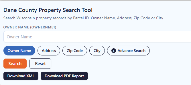
A parcel number is one of the most reliable ways to locate a specific Adams County property record. Enter the parcel number exactly as shown on a tax bill, assessment record, or other property document. Check each digit before searching because one incorrect number can return a different property or no matching result.
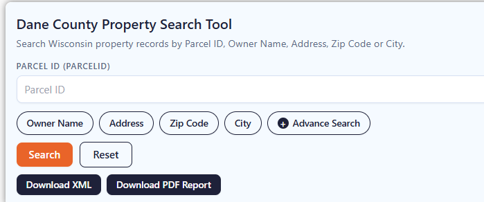
If the property address is available, select the Address option and enter the street information carefully. Include the house number and street name as they appear in the property record. If the property checker does not return the expected result, review the spelling, street abbreviations, and house number before trying again.
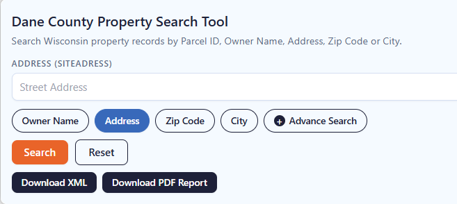
The ZIP Code option can help when you know the property’s general location but do not have its parcel number or complete address. Enter the five-digit ZIP code and review the matching properties. Since multiple parcels can share the same ZIP code, compare the displayed addresses and owner information to identify the correct property.
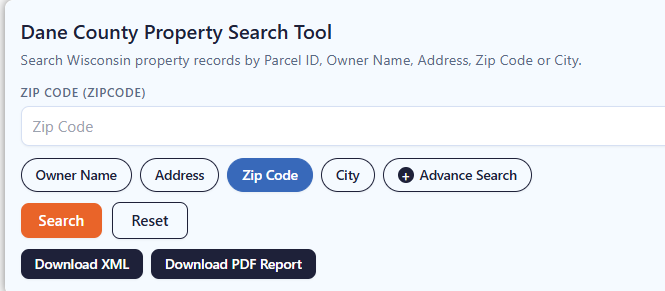
Choose City Name when you know where the property is located but do not have enough information for an address or owner search. Enter the applicable city name and review the available records. The Adams County property search tool can then help narrow the results until you find the property you’re looking for.
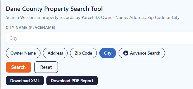
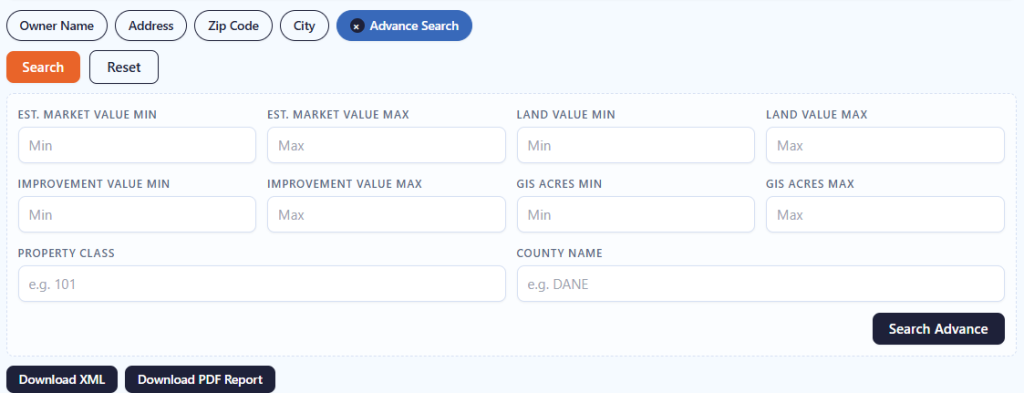
Advanced Search is useful when you have several pieces of property information and want to narrow the results. Depending on the available fields, you can use additional details to make the search more specific. Enter only information you know is correct, then review the results carefully before opening a property record.
What Information Can You Find in Dane County Property Record?
A property result can bring together identification, ownership, location, assessment, classification, acreage, tax, and mapping details. The exact information displayed can vary by parcel and by the underlying source data, so individual fields should be read in context rather than treated as independent legal conclusions.
Parcel and Tax Identification
The parcel ID or tax parcel number provides the primary reference for a property record. It helps distinguish one parcel from another, particularly when several properties share similar addresses or ownership names. Keep the complete identifier when conducting follow-up research because municipal coding and parcel numbering are part of the county’s property-record structure.
Property Owner Information
The record can show primary and secondary owner names, allowing you to see whether ownership information contains one or multiple listed parties. This is particularly useful when checking a property by owner name. The two owner fields can help you compare the names associated with a parcel instead of relying on a single ownership entry.
Property Address
The site address identifies where the property is physically located, while the mailing or billing address can be different. This distinction matters for owners who live elsewhere or for properties held by businesses and investment entities. Comparing both addresses can help researchers understand whether the tax or correspondence address corresponds to the actual property location.
Parcel Location
Location details can connect the record to its municipality, place name, street information, and other geographic descriptors. Dane County contains a mix of incorporated cities and villages and unincorporated towns, making the municipality field particularly useful. It can help determine which local government has jurisdiction over a property or which municipal office may need to be contacted.
Assessed Property Values
The record contains several value fields, including county assessed value, land value, improvement value, and MFL value. Looking at these figures separately can help you understand how the property’s assessed amount is represented across land and improvements rather than seeing only one combined property value.
Land and Improvement Values
Some records separate the value attributed to land from the value attributed to improvements such as buildings. Looking at the two components can provide a clearer picture of how the recorded assessment is structured. This is particularly useful when comparing vacant land with developed parcels or examining how buildings contribute to a property’s total assessed value.
Property Classification
Property class and auxiliary classification fields can help describe the general category assigned to a parcel. Classification may distinguish residential, agricultural, commercial, manufacturing, or other property types where the underlying dataset supports those distinctions. These fields are useful for research and comparison, but a classification label should not by itself be treated as a complete determination of permitted land use.
Property Acreage
Several acreage measurements are available, including assessed acres, deed acres, and GIS acres. These values may represent acreage from different property or mapping sources, so they should not automatically be treated as identical measurements. Having all three fields available gives you more detail when comparing the property’s recorded size.
School District Information
A parcel can have several acreage measurements depending on how the underlying information was compiled. Assessed acres, deed acres, and GIS acres may appear as separate fields. Differences do not necessarily mean the record is incorrect; each measurement can reflect a different source or purpose. For legal boundary questions, rely on recorded documents and professional survey information rather than a database acreage figure alone.
Geographic and Mapping Data
GIS-related information can include latitude, longitude, parcel geometry, mapping references, and source information. These fields are useful for placing a parcel within a broader geographic context and for comparing nearby properties. Dane County cautions that its parcel maps are intended for tax and property-listing purposes and are not substitutes for a professional land survey.
Areas Covered by the Dane County Property Search Tool
Property research can span a wide area because the county includes urban neighborhoods, suburban communities, villages, and rural towns. The property database can therefore be useful for comparing parcels across different local jurisdictions rather than limiting research to Madison alone. Dane County’s current municipal listing identifies cities, villages, and towns across the county.
City of Edgerton
City of Fitchburg
City of Madison
City of Middleton
City of Monona
City of Stoughton
City of Sun Prairie
City of Verona
Village of Belleville
Village of Black Earth
Village of Blue Mounds
Village of Brooklyn
Village of Cambridge
Village of Cottage Grove
Village of Cross Plains
Village of Mazomanie
Village of McFarland
Village of Mount Horeb
Village of Oregon
Village of Rockdale
Village of Shorewood Hills
Village of Waunakee
Village of Windsor
Town of Albion
Town of Berry
Town of Black Earth
Town of Blooming Grove
Town of Blue Mounds
Town of Bristol
Town of Burke
Town of Christiana
Town of Cottage Grove
Town of Cross Plains
Town of Dane
Town of Deerfield
Town of Dunkirk
Town of Dunn
Town of Medina
Town of Middleton
Town of Montrose
Town of Mazomanie
Town of Oregon
Town of Perry
Town of Pleasant Springs
Town of Primrose
Town of Roxbury
Town of Rutland
Town of Springdale
Town of Springfield
Town of Sun Prairie
Town of Vermont
Town of Verona
Town of Vienna
Town of Westport
Town of York
Village of Dane
Village of DeForest
Village of Deerfield
Village of Maple Bluff
Village of Marshall
Dane County Information at a Glance
Dane County combines Wisconsin’s capital city with a large network of suburban, rural, and agricultural communities. Its population has grown substantially over recent decades, and its property landscape includes everything from urban parcels in Madison to farmland and smaller residential communities.
| County Detail | Dane County | County Detail | Dane County |
|---|---|---|---|
| County Seat | Madison | State | Wisconsin |
| 2025 Population Estimate | 590,375 | Land Area | 1,196.49 sq. mi. |
| County FIPS Code | 55025 | Water Area | 41.79 sq. mi. |
| 2020 Census Population | 561,504 | Homeownership Rate | 57.1% |
| Median Home Value | $394,800 | Median Household Income | $89,975 |
| Median Gross Rent | $1,398 / month | Median Mortgage Cost | $2,200 / month |
| Housing Units | 276,609 | Households | 251,529 |
| Population Density | 469.3 / sq. mi. | County Created | December 7, 1836 |
| Building Permits | 6,629 in 2025 | Major Water Features | Lake Mendota, Monona, Waubesa & Kegonsa |
| Fully Organized | May 6, 1839 | Geographic Region | South-central Wisconsin |
Nearby Wisconsin Counties
Property research often crosses municipal and county boundaries, especially around the Madison region and rural communities near the county line. These nearby Wisconsin counties provide useful starting points when the property you are researching falls outside Dane County.
Frequently Asked Questions
How can I find a Dane County property by parcel number?
Use the parcel-number search when you already have the property’s tax parcel identifier. It is generally more precise than a broad owner or city search. Dane County’s parcel system uses municipal coding as part of its parcel identification structure, so retaining the complete number can help with accurate matching.
Can I search for a property using only the owner's name?
Yes. An owner-name search can help locate parcels associated with an individual or organization when you do not know the street address. Names may appear differently because of initials, businesses, trusts, or multiple owners, so trying a reasonable variation can sometimes produce better results.
What if I know the address but not the parcel ID?
An address search is designed for that situation. Start with the street number and street name, then review the returned municipality and property details to make sure the result corresponds to the property you intended to research.
Are Dane County property records the same as a deed?
No. A parcel record and a recorded deed serve different purposes. A property database can help identify a parcel, owner information, location, and assessment-related details, while the Register of Deeds maintains recorded real-estate documents. For legal title or the complete legal description, consult the recorded document.
Why might the mailing address differ from the property address?
A property owner may live at another location, use a separate billing address, or own the property through a business or other entity. Dane County distinguishes property and billing address functions, and Property Listing handles address-related updates.
Can I search properties in Madison and the surrounding towns?
Yes. The county’s property information covers parcels across its cities, villages, and towns. Madison is only one part of the county’s property landscape; searches can also involve communities such as Middleton, Fitchburg, Sun Prairie, Verona, Waunakee, Oregon, and numerous rural towns.
Does an assessed value tell me what a property is worth today?
Not necessarily. An assessed value is associated with property assessment and taxation, while market value reflects what a property might command in an open-market transaction. A database value should therefore be treated as assessment information rather than a guaranteed current sale price.
Should I rely only on a property search when buying real estate?
No. A property search is a research tool, not a substitute for professional due diligence. For a purchase decision, you may also need current documents, inspections, title work, surveys, zoning confirmation, and advice from qualified professionals.
Can I use the property search to research an old property record?
That depends on the records and historical information available in the underlying database. If you are researching an older ownership or property history, verify the information against the appropriate county records or other official documents.
What should I do if property information appears incorrect?
Start by identifying the exact parcel number and reviewing the record carefully. For property-listing or billing-address issues, Dane County provides Property Listing contact guidance through the Planning & Development Department. For recorded-document questions, contact the Register of Deeds; for assessment questions, the appropriate municipal assessor may be the better source.